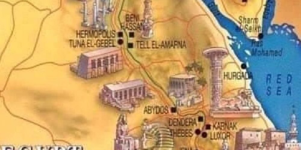
Ancient Egypt, an awe-inspiring civilization that thrived for over 3,000 years, was defined by its unique geographical features. The map of Ancient Egypt is centered around the Nile River, which played a pivotal role in shaping the civilization. The landscape, divided into Upper and Lower Egypt, was a blend of fertile land, deserts, and key landmarks that allowed Egypt to prosper as one of the world’s greatest civilizations. In this article, we’ll take a closer look at the Ancient Egypt map, focusing on its key regions, cities, and geographical features that were essential to its development.
- Egypt Tour Magic
- Egypt Tour Packages
- Excursions in Egypt
- Cairo Tours and Excursions
- Hurghada Tours and Excursions
- Soma Bay Tours and Excursions
- Makadi Bay Tours and Excursions
- Sahl Hasheesh Tours and Excursions
- El Gouna Tours and Excursions
- Marsa Alam Tours and Excursions
- Port Ghalib Tours and Excursions
- El Quseir Tours and Excursions
- Dendera and Abydos Day Tours
- Aswan Tours and Excursions
- Luxor Tours and Excursions
- Alexandria Tours and Excursions
- Sharm El Sheikh Tours and Excursions
- Top Rated Tours in 2025
- Optional Excursions in Egypt
- Private Transfer
- Blogs About egypt
- Ancient Egypt
- What You Need To know Before Your First Trip To Egypt
- Best Places to Visit in Egypt 2025
- Top Attractions in Red Sea Resorts 2025
- Top 10 Tourist Activities in Egypt
- Top 30 Activities You Can’t Miss in Egypt
- The Guide to Guided Tours in Egypt
- Egypt’s Ancient and Modern History
- The Nile River
- The Deserts of Egypt
- Historical Sites in Egypt
- Cairo
- Alexandria
- Luxor
- Aswan
- The Red Sea
- Dendera Temple
- El Fayoum Oasis
- Bahariya Oasis
- Siwa Oasis
- Al Alamein
- Marsa Matruh
- Ancient Egyptian gods
- famous Egyptian dishes
- UNESCO World Heritage sites
- About Us
- Why Egypt Tour Magic
The Ancient Egypt Map
1. The Nile River: The Lifeblood of Ancient Egypt
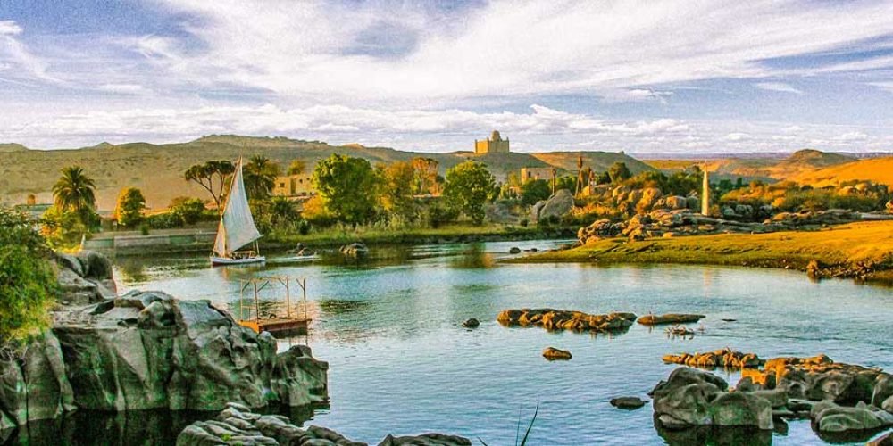
The Nile River was the cornerstone of Ancient Egyptian civilization, providing both sustenance and transportation for its people. Flowing from the Mountains of East Africa to the Mediterranean Sea, it is the longest river in the world, spanning over 4,000 miles. The Nile’s annual flooding, which deposited nutrient-rich silt onto the surrounding land, ensured that agriculture could thrive along its banks. This created fertile soil for crops like wheat, barley, and flax, which supported Egypt’s large population and economy. In addition to providing fertile land, the Nile served as a vital transportation route for goods, soldiers, and communication between the northern and southern regions of Egypt. The river’s role in unifying Upper and Lower Egypt allowed the civilization to flourish for millennia, making it one of the most enduring and powerful in history. The Nile not only shaped Egypt’s economy but also influenced its religion and culture, as it was seen as a divine gift from the gods.
2. Upper Egypt: The Southern Region
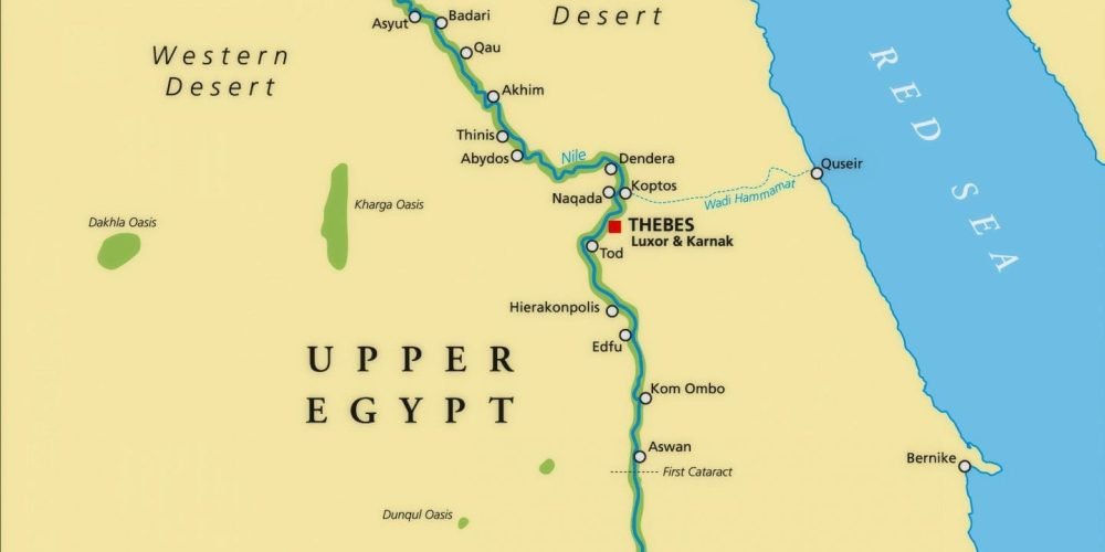
Upper Egypt, situated in the southern part of the country, was home to some of the most significant cities and archaeological sites in Ancient Egypt. The region is characterized by its narrow strip of fertile land along the Nile River, surrounded by the harsh desert. Upper Egypt’s elevated position in the south gave it the name “Upper,” despite it being geographically lower than Lower Egypt. Thebes, located in Upper Egypt, was a prominent city during the New Kingdom, serving as the capital of Egypt for several dynasties. It was a center of power and culture, with monumental sites like the Temple of Karnak and the Valley of the Kings, where pharaohs such as Tutankhamun were buried. Upper Egypt also bordered the kingdom of Nubia, which had strong cultural and economic ties with Egypt. This region’s history is deeply intertwined with the rise of powerful dynasties and religious developments, particularly during Egypt’s imperial expansion into Nubia. Upper Egypt played a significant role in Egypt’s political and religious leadership, particularly through its capital cities and royal tombs.
3. Lower Egypt: The Fertile Northern Region
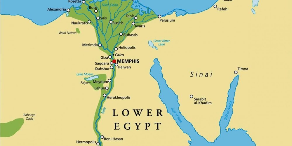
In contrast to Upper Egypt, Lower Egypt refers to the northern region of Egypt, where the Nile River fans out into the Nile Delta before flowing into the Mediterranean Sea. The delta’s expansive, fertile land was perfect for agricultural production, which helped sustain the growing population of Egypt’s northern provinces. The flat, lush terrain of Lower Egypt made it the primary agricultural hub, with abundant crops such as wheat and flax being cultivated. It was also home to some of the most important cities in Egyptian history, including Memphis, which served as the capital for much of the Old Kingdom. Memphis was a key political and cultural center and played an essential role in the religious life of the civilization. Another important city was Alexandria, founded during the Hellenistic period by Alexander the Great. Alexandria became a beacon of learning and intellectual achievement, home to the famous Library of Alexandria. The wealth of Lower Egypt, combined with its strategic location along the Mediterranean, made it an influential region throughout Egypt’s history.
4. The Deserts: Natural Barriers and Resources
The deserts surrounding Egypt – the Eastern Desert and the Western Desert – acted as natural barriers, providing protection from foreign invasions and shaping the cultural and military landscape of Ancient Egypt. The Eastern Desert was largely arid but rich in mineral resources, including gold, turquoise, and semi-precious stones. Ancient Egyptians mined these resources, which contributed to their wealth and trade. The desert also contained routes for trade caravans, connecting Egypt to the regions of Arabia and the Red Sea. The Western Desert, on the other hand, is famous for its vast sand dunes and remote oases, such as the Libyan Oasis, which provided fertile land in an otherwise barren landscape. The Western Desert also housed the burial sites of some of Egypt’s most famous pyramids, including those on the Giza Plateau. These deserts were not just geographic features; they were integral to the defense, trade, and culture of Egypt, influencing everything from Egypt’s military to its burial practices.
5. Key Landmarks and Monuments on the Map of Ancient Egypt
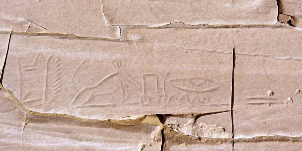
Ancient Egypt’s map is dotted with remarkable monuments that reflect the civilization’s engineering prowess and deep religious significance. Among the most iconic structures are the Great Pyramids of Giza, located just outside modern-day Cairo. These monumental structures, including the Pyramid of Khufu (also known as Cheops), were built as tombs for the pharaohs during the Old Kingdom. The Sphinx, a massive stone statue with the body of a lion and the face of a pharaoh, is another well-known landmark near the pyramids, representing the power and divine nature of the pharaohs. Moving south, the city of Thebes became the capital during the New Kingdom and was home to the grand Temple of Karnak, dedicated to the god Amun-Ra. This vast temple complex contains some of the most impressive columns and hieroglyphic carvings in Egypt. Just west of Thebes lies the Valley of the Kings, a vast burial ground where many pharaohs, including Tutankhamun, were interred in richly adorned tombs. These monumental landmarks reflect Egypt’s religious devotion, royal power, and architectural genius. Their continued presence today is a testament to Egypt’s enduring legacy.
6. The Oases: Hidden Gems in the Deserts
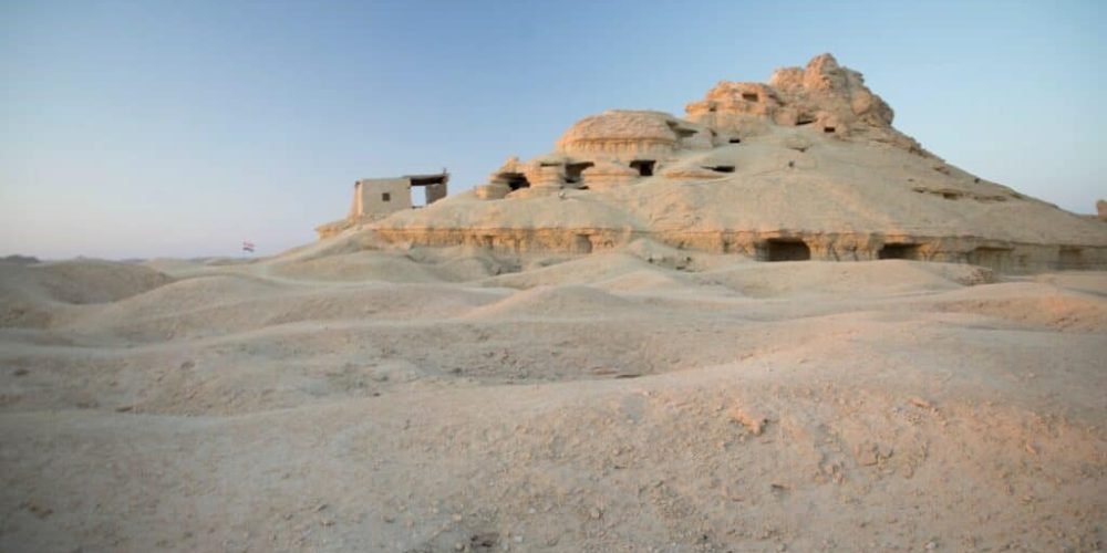
Scattered across the vast Western Desert and Eastern Desert of Ancient Egypt are several key oases, which were crucial to the survival and expansion of the civilization. These oases were natural sources of fresh water in an otherwise arid landscape, providing fertile land for agriculture and acting as vital stopping points for trade caravans. The Siwa Oasis, located to the west of the Nile, was one of the most famous oases and was home to the sacred Temple of Amun. It was considered an important spiritual center, and the oracle of Amun at Siwa was consulted by various Egyptian rulers, including Alexander the Great, who visited the oracle in 332 BCE. Another significant oasis was the Kharga Oasis, which served as a trade route between Egypt and the rest of the ancient world, providing essential resources like dates and palm trees, as well as strategic military locations. The oases also played a role in Egypt’s military history, as they provided safe havens for soldiers and supplies during times of conflict. These desert gems were crucial for Egypt’s economic stability and military strength, helping the civilization thrive in an otherwise harsh environment.


